A place legends are made from.
[Hit Counter]
 Bamfield is a
very unique town in a very unique place.
Bamfield is a
very unique town in a very unique place.
What makes it so special is it is a refugium, a
place the glaciers could not hit. Its literally a paradise, an oasis in the north.
In 1902 the cable station was under way and there is a reason why the cable station was
placed here .
In the 1970's the cable lands was
bought and they placed the bms, marine sciences center there.
According to the powers that be, the area in yellow had no serious Spanish colonies
living here before 1840, yet there is lots of evidence.
They say Definitely no Vikings or Inca connected colonies could have possibly lived
here. They say Historically speaking it's boring.
I believe they are wrong and that the place has
been a destination by sea, for people throughout history. 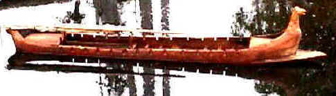
I have had the pleasure of spending some time with an old Indian story teller for the
local tribe.
Willy claimed there was a people here before his people, he claimed the caves I found were
used and created by them and he called them the people from the beginning of time . He
even said they had colored eyes. These caves are found on the cliffs of the
west coast and they can be found, no other place in the the world.
When I took Wily to the summer solstice cave, he pointed me to an island and said there is
a Meiden mans solstice cave on it, he asked me if I had been to it. I had not and
did not know were it was. I had not found it till this year, but once I found it, I
knew I found Willis cave right away.
I have placed some legends and some pieces of some stories I wrote about this place below.
Read them and see for your self, what a magical place we live in.
Decide for your self if any sea faring traveler ever settled here.
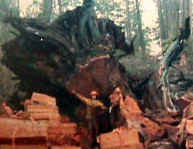
In 1993 I made a video about selectiv logging
and approached the environmentalist's. I was seeking help to get awareness to the
historical connections to this mountain. During the protesters I spent time with the
environmentalists and calyqouot rendezvous, in both groups I truly found people who
cared.
Being labeled a environmentalist and my uneducated theory has in the eyes of some , made
me nuts.
Read my
theory about the forest and my history story and decide if you agree, that I am nuts. If
you have made it here and agree leave.
This page is just a intro to my book. If I publish my book you will see it's not
another Bre x .
 MANAlcp
It started in 1985 when i found an old placer mine
on this mountain \/.
Look up grappler from the mouth of the harbor and you can see it .
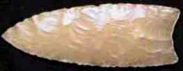
On this mountain is a felsite and quartzite deposit. This is also the stone
the Clovis used for there spear points.
Very distinct because of the fluited [concave] ends.
Notice the mountain where the feldsite vein is and the agute vein
crosses.
It's the same shape as the clovis spear point.
Again
Wait till the summer solstice and the mountain turns to gold 
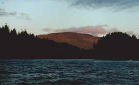
Gold on a mountain that turns to gold.
Once I found the placer mine, which the laws prohibited me from placer mining the
old placer mine. I realized I found old chief Louie's lost mine from his story. I
figured I found a important historical mine so I began to read documented legends, to see
if they fit what I found.
As I was a prospector I did a proposal for a mining
company, International Cherokee and beu prey minerals. when I showed Mr. beu prey the
picture of the miniature mountain he thought it was real gold. They sent a geologist down
to do a report for me.
The first book I bought was "lost bananzas of western Canada. " it had the
Spanish massacre story and BC's lost mines.
In the Spanish story a young girl found the gold.
"she produced a handful of pretty stones which
she had broken of a big yellow rock"
All along the coast the Indians have stories about the Spanish gold mine.
The local band were I live, claims they used to go get gold and use it in ceremonies in
the caves.
[See the hearts page] The best stories are the ones in the daughters of copper women.
Watch the video of
Willy in the cave as he shows the connection between the caves and gold.
I read the story about a prospector from port Renfrew ,who found raw gold, so the story
goes. "fosters mine"
In the story he flashed very rich gold.
 "Foster
was flashing his gold-not just nuggets but chunks of the prized ore, hacked from a ledge
high up the San Juan"
"Foster
was flashing his gold-not just nuggets but chunks of the prized ore, hacked from a ledge
high up the San Juan"
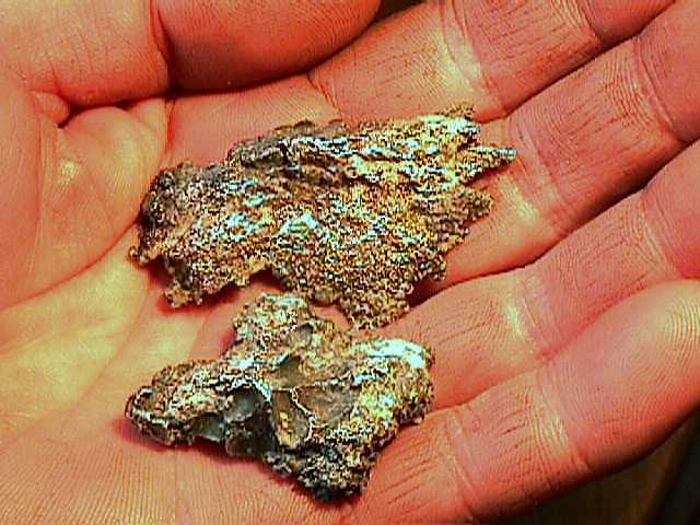
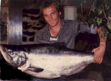
These are pictures of Walters fathers gold. Years ago, before Walt died, he showed me a
piece of bull quartz, about a inch across, it had a piece of slate and a 1 ounce chunk of
raw gold in it. He said he had a bigger one and there was some silver pieces
as well.
The piece's above are 2 pieces of the
silver/gold ore, his wife showed them to me after he died.
Old Walter told me the story about his fathers gold mine and showed me his gold pieces.
The pick marks can been seen on the lower piece.
Dave's story --------
Fosters mine legend was
the same story as Walters, yet foster never had the gold to prove it, Walter
did.
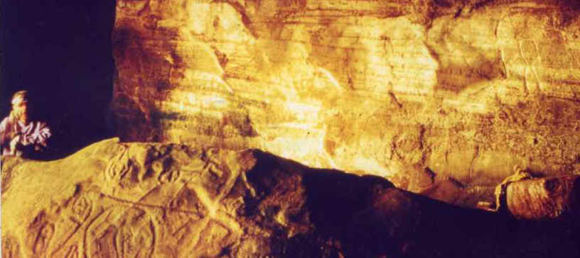
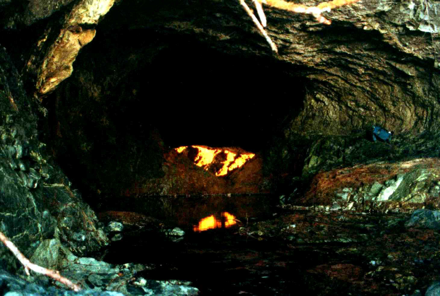
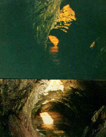
In 1986 I found something amassing, a legend
about a local cave that had a miniature of a mountain in it, a mountain that is
illuminated by the setting sun .
On the setting sun of the solstice we went to bradies beach and entered the cave in the
legend.
We searched for the mountain and this is what we found in the cave.
"Wow" It
was a replica of the mountain and it was pure gold.
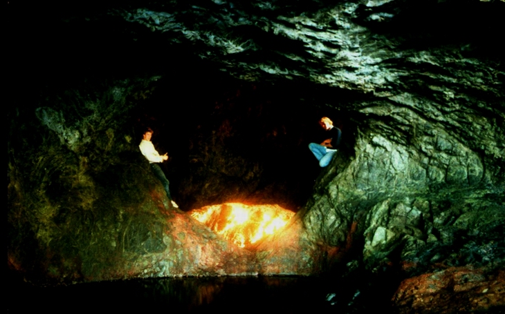
My first reaction.
"Evidence of a past culture that built solstice
caves dedicated to this mountain"?
This was UN acceptable and I got little support for my theories. But it did not stop me
from showing what I found.
Living so close to a
university, I started to take students to see the amassing site.
For nearly 20 years students, friends and I have been visiting the site. Yet still, the
government openly laughs at me and denies even the Spanish set foot in Barclay sound pre
1840.
Well its 2004 and I have found more.
 I found willies cave
and the cave has tiny drops of water on the ceiling, it looks like little quartz
crystals on the ceiling.
I found willies cave
and the cave has tiny drops of water on the ceiling, it looks like little quartz
crystals on the ceiling.
The most recent important find is another ceremonial cave, found by a rcmp
officer. I know the Island the cave is on and I know there was found to
have, very odd DNA in the bones. This was accompanied by fluting in the obsidian and
slate spear points. Ron told me about the cave and the other info came from the
archeological investigation of the island. The unfortunate thing is, the GOV will not
admit to it.
Read the legends I believe connect the people from the past, to the caves and
Barkly sound.
Start with chief Louie's legend, the first legend I read and Paunine Johnson's legend.
One thing to note, Louies legend had the location of the cave written at the end, so
it was not hard to find. I followed the directions from the book and the legend to find
the miniature mountain in the cave.
Chief Louie's Legend 
The cave of Koa swilth "the thunder caves" can
be approached by paddling through the kelp beds which lie off shore to a tiny little
harbor in which a landing can be made on a shelf of rock about a hundred yards from the
mouth if the cave .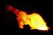
Entering an arched portal into the gloom of the cave there is a
round pool of water some 12 feet from side to side .  A mosaic of multi colored sea
growth in shades of orange, yellow cerise red crimson lake and
A mosaic of multi colored sea
growth in shades of orange, yellow cerise red crimson lake and purple hue lines the sides below and above the level of the water,
in the placid surface of which the colors are mirrored blending with the reflection of the
olive greens ochres of the vaulted roof.
purple hue lines the sides below and above the level of the water,
in the placid surface of which the colors are mirrored blending with the reflection of the
olive greens ochres of the vaulted roof.
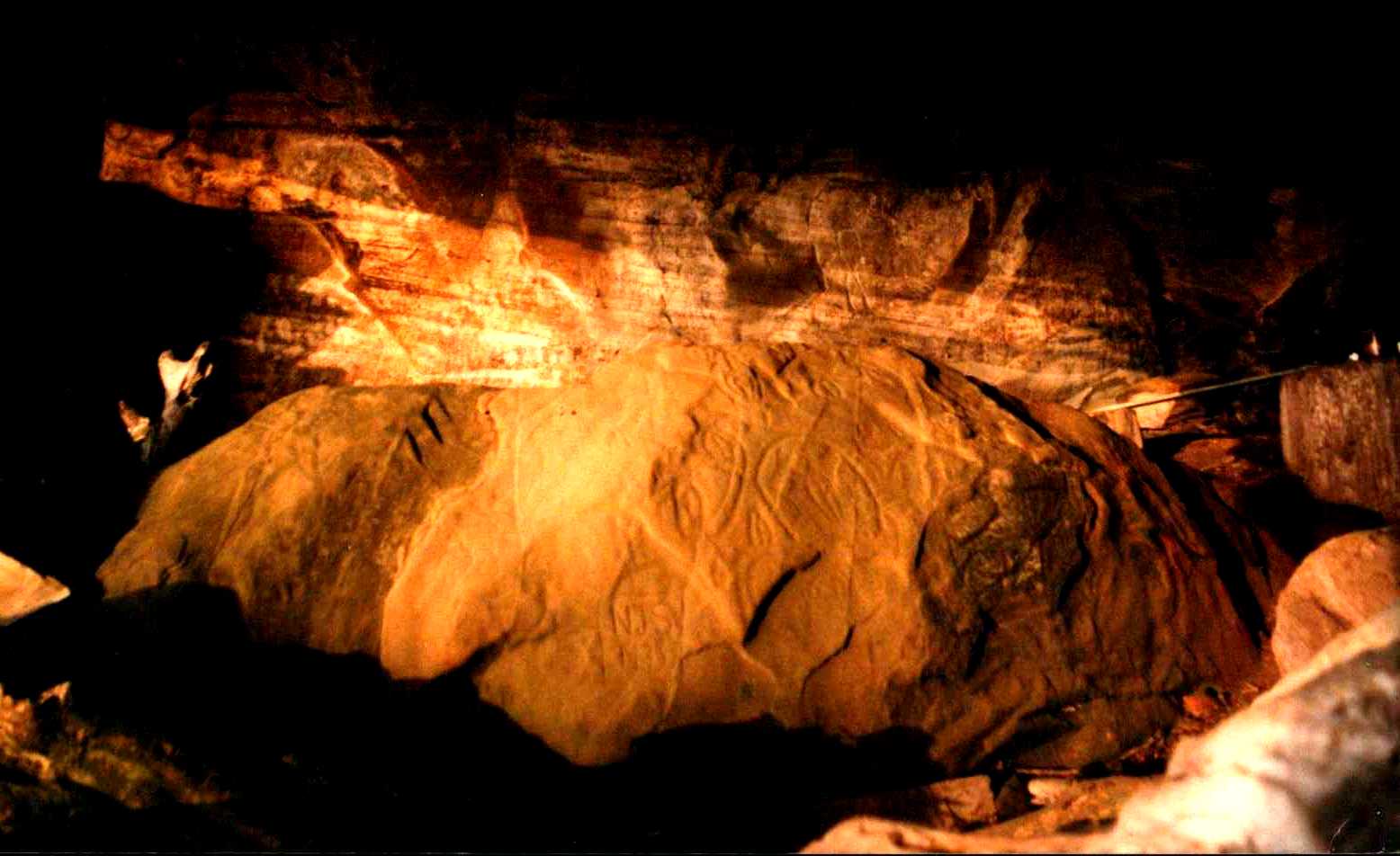
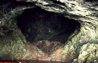 What appears to be a miniature
mountain range rose colored red is set in a dark heart shape frame of rock. it is placed
on the wall at the end of the cave. Climb around the slippery sides of the pool and their
is a second cave longer and deeper then the first one. A miniature mountain
range rises from the flour, perfect in every detail, serrated peaks, precipitous
gorges and bold
What appears to be a miniature
mountain range rose colored red is set in a dark heart shape frame of rock. it is placed
on the wall at the end of the cave. Climb around the slippery sides of the pool and their
is a second cave longer and deeper then the first one. A miniature mountain
range rises from the flour, perfect in every detail, serrated peaks, precipitous
gorges and bold  bluffs. Along the foot of the range lies a
miniature lake. Through the second cave, the setting sun of the summer solstice shines in
the, in such a manner as to light the upper slopes and peaks of the diminutive mountain
ran
bluffs. Along the foot of the range lies a
miniature lake. Through the second cave, the setting sun of the summer solstice shines in
the, in such a manner as to light the upper slopes and peaks of the diminutive mountain
ran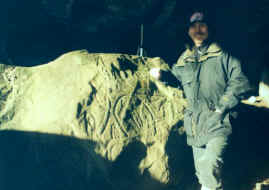 ge, revealing rich tints of gold and giving the effects of a sunset
scene.
ge, revealing rich tints of gold and giving the effects of a sunset
scene.
the siwash rock
 I have been to these sacred places with old
Willy the Indian story teller, he told me that they where made by the people from the
beginning of time.
I have been to these sacred places with old
Willy the Indian story teller, he told me that they where made by the people from the
beginning of time.
In 1911 an old Indian chief took a young lady, Pauline Johnson to this sacred place.
Their reaction,
''Unique and so distinct from its surroundings as to suggest rather a
handy craft of man then a whim of nature'' It looms up at the entrance to the narrows ,a
symmetrical column of gray stone.'' ''I saw it first in the redly setting august sun, its
colossal base of gray stone gleamed like flaming polished granite.''
The legend continues. ''My old tillicum ( friend) lifted
his paddle blade to point towards it .'' You know the story? ''he asked. For a time we
paddled slowly:" The rack detached itself from its back ground of forest and shore,
and it stood forth like a sentinel, erect enduring and eternal.'' Do you think it stands
straight like a man?''he asked.'' yes like a noble spirited upright warrior ''I
replied."

It is a man'', and a warrior man to: a man who fought for everything that is
noble and upright.'What do you regard as noble and upright chief?�I asked . He said
simply .'' clean fatherhood''.
"It was thousands of years ago that a
handsome young boy chief journeyed in his canoe to the upper coast for the shy little
northern girl whom he brought home as his wife.''soon his wife was with a child, He
brought her to the Sacred place to have her baby. The boy leapt into the water to swim for
clean father hood, in his swim he met the great leaders boat and would not let the boat
pass.The Sagalie Tyee said .''Because you have defied 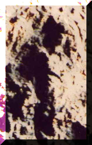 all
thing that comes in your path we promise this to you .You have defied what interferes in
your child's chance for a clean life,you have placed that child's future before all things
and for this this the sagalie tyee commands us to make you ever a pattern for your tribe
.You shall never die, but you shall stand through the thousands of years to come, where
all eyes can see you. You shall live,live, live as an indestructible monument to clean
fatherhood. The four men lifted their paddles and the handsome young chief swam inshore.
as his feet touched the line where sea and land met he was
transformed into stone. Then the four men said, "His
wife and child must ever be near him. They to where turned to stone.
all
thing that comes in your path we promise this to you .You have defied what interferes in
your child's chance for a clean life,you have placed that child's future before all things
and for this this the sagalie tyee commands us to make you ever a pattern for your tribe
.You shall never die, but you shall stand through the thousands of years to come, where
all eyes can see you. You shall live,live, live as an indestructible monument to clean
fatherhood. The four men lifted their paddles and the handsome young chief swam inshore.
as his feet touched the line where sea and land met he was
transformed into stone. Then the four men said, "His
wife and child must ever be near him. They to where turned to stone.
If you penetrate woods near the rock you will
find a large rock and a smaller one beside it. Some day I'll show you the big rock.
 He told me the
legend that fewer Indians know today,It was not always there , that great rock. For it too
was once a great tyee who ruled the mighty tract of waters.He would laugh and defy the
sagarlie tyee. It was at this time that the sagalie tyee in the persons of the four men
came in the great canoe.
He told me the
legend that fewer Indians know today,It was not always there , that great rock. For it too
was once a great tyee who ruled the mighty tract of waters.He would laugh and defy the
sagarlie tyee. It was at this time that the sagalie tyee in the persons of the four men
came in the great canoe.
It was all rock and dense forest and it provided shelter from the terrors of the west
wind, he made this strip of land his last stand against the four men. As the bow touched
the land the four men arose and they pleaded him to cease.
 The four men cried, you have been to great
a god for even the sagalie Tyee to obliterate you for ever ,but you shall live on ,live
now to serve , not to hinder mankind.you shall turn into
stone where you now stand, and you shall rise only as men
wish you to. Your life from this day shall be for the good of man. You shall stand through
all the thousands of years upon thousands of years to come."
The four men cried, you have been to great
a god for even the sagalie Tyee to obliterate you for ever ,but you shall live on ,live
now to serve , not to hinder mankind.you shall turn into
stone where you now stand, and you shall rise only as men
wish you to. Your life from this day shall be for the good of man. You shall stand through
all the thousands of years upon thousands of years to come."
Legends of Vancouver
Pauline Johnson 1911

Pauline's legend's clearly say that thousands of years ago, on this coast, a
man was turned to stone.
I don't know about you but I see a man set in stone on
the walls of these caves and who knows what lies beneath the
sand in the solstice cave Willy told me about.
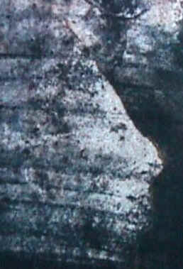
Having some knolage about prospecting, and history
<<I can tell you, its a granite wall that has
been chipped so that the shadows of the setting sun create the image of a man's
profile.
The other picture is pigments embedded in sand stone, it paints a
picture.>>
Its cave art done through the art of illusion and done by the first nation.
Although the dna still runs in the blood of some natives, the nation and culture are
gone from the west coast.
 As I said,
this summer I learned that one of the islands with burial caves, had very unusual
DNA in the bones. const Ron saw a ceremonial cave and saw a connection to a local
Indian family.
As I said,
this summer I learned that one of the islands with burial caves, had very unusual
DNA in the bones. const Ron saw a ceremonial cave and saw a connection to a local
Indian family.
This is a local child, a young Indian girl from the Ohait tribe . I found the picture in
the garbage drop but I know she is the for mother of my friends. Have a close look at her
features, blond streaks and brown eyes. Maybe a relative of the Spanish or maybe the
descendents of the odd DNA.
If we do not stop hidding history, we may never know.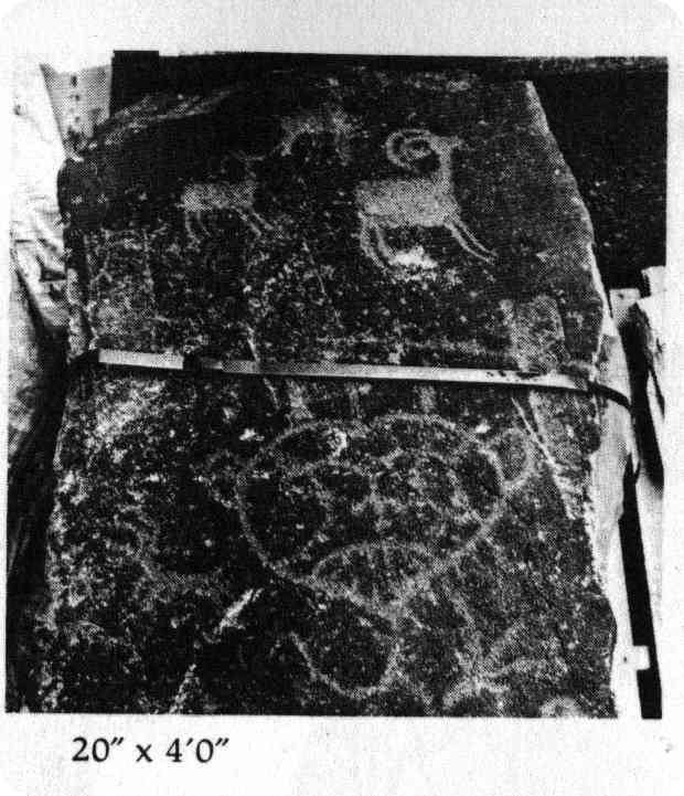
The legend claims "a heart
shaped frame of rock".
Follow the link to part of my story about the hearts in America.
What's
the heart doing in America
 Vikings in America?
<The Vinland map
/ Vancouver island>
Of course I immediately thought what I found was some lost civilization like
Atlantis. But it was not lost, It was right here. 
And like the bms, I was living in the same location.
This got me thinking about others from history who may have visited this place by boat.
I then found this map and figured "Vikings" why not.
The next story is not a legend, but just my theory about
this lost Viking Cats.
 The Vikings made it to Maine
and they left their cats behind, The Norwegin forest cat
The Vikings made it to Maine
and they left their cats behind, The Norwegin forest cat

 These native north American cats are known as the maincoon. They are native to north
ameriac cats from around main. They are very valuible.
These native north American cats are known as the maincoon. They are native to north
ameriac cats from around main. They are very valuible.

In 1985 two main coon cats walked out of the bush and took up
residence with a logging camp.<<
Years later my father found a kitten in the bush , She was Grey and pink with a flat face
, believe it or not she tweeted like a bird. she had 1 batch of kittens then I had her
fixed. 2 short hared females and 1 male , I kept the male. Fatso
This is Fatso,before he was taken , fixed then put to sleep.
I kept fatso's gene's going till some one took him in as a wild cat. and got him fixed. .
Before this my brother had a small black female, fatso became the father, I took the
female kitten, she had many kittens, but only the males were the fluffy Vincoons,
they were easy to give away. She had a batch of kittens only in the spring.

This guy is the young
fellow sitting in front of fatso, He was nuddered and is 3 years old.
Offer me enough $ and he's yours.
 When
I knew fatso was not coming back, I kept this kitten. It turned out to be a female, the
only female with the main coons features I ever got.
When
I knew fatso was not coming back, I kept this kitten. It turned out to be a female, the
only female with the main coons features I ever got.
The picture below is the sister of the cat with the main.

She is Identical to Steve's old cat, except for the pink. you can see the pink fur
on the inside of her legs.
I believe the cat is a product of evolution, kittens in the spring and when you get close
they crouch down, other wise you never see them..
 But this is her uncle, I knew what it would look like so I gave to my
mother. She tried to give it back because it would not come out from under the couch.
These cats are shy, If they don't know you, you will not see them. This is the only
picture I can get of mums cat so far. It is a huge beast and I would pay money for
this cat and soon I will have more. I don't think my mother ,or any one has ever seen the
young fellow.
But this is her uncle, I knew what it would look like so I gave to my
mother. She tried to give it back because it would not come out from under the couch.
These cats are shy, If they don't know you, you will not see them. This is the only
picture I can get of mums cat so far. It is a huge beast and I would pay money for
this cat and soon I will have more. I don't think my mother ,or any one has ever seen the
young fellow.
I am calling them
The Vincoone
20 years ago, the vincoone cat did the same as its brother the main coon. It walked into
the back door of a cabin in the wilds of America. The map of Vinland is Vancouver
island and the vincoone was there cat.
I am curious to see what the children of my kitten will look
like.
Any way, enough of cats, read the paper I wrote in 1995 About, "Vikings in barkly
sound". I had a professor edit it for me. Its quite well done. For more on vikings go
to the navigation page..
Vinland Rediscovered Paul
Demontigny 1996
(This report is dedicated to my co-researcher, Monica) and edited
by dr daived martin
Discovery: Sometimes
its finding something for the first time: But sometimes it'’ finding something
important that has been lost, like King Solomon’s mines or Noah’s Ark. Discovery is a word that sets the blood
moving….
Parks
Canada thinks that Vinland was discovered in Newfoundland.
They made a park at L’Anseaux Meadows to show off the discovery. While in reality, Vinland is out here on the other
side of Canada, in another park that was set up simply to showcase the beauty of the West
Coast.
How
dare anyone question the wisdom of those experts? Well,
Vinland was a name given by Vikings to a place they found and the way to locate Vinland is
therefore to follow their (record) retrace their voyages, and locate the area where the
settlement they called Vinland was built.
 I’m not saying that there aren't’t the remains of a
Nordic settlement in Newfoundland. There
pretty surly are- the Vikings were incredible invaders and even Native Legends from here
to the Mohawks, describe them as the “people of motion.” My point is that Viking descriptions of Vinland
the Good do not point to Newfoundland. Was there a different Viking site, probably the one
they called New Ireland.
I’m not saying that there aren't’t the remains of a
Nordic settlement in Newfoundland. There
pretty surly are- the Vikings were incredible invaders and even Native Legends from here
to the Mohawks, describe them as the “people of motion.” My point is that Viking descriptions of Vinland
the Good do not point to Newfoundland. Was there a different Viking site, probably the one
they called New Ireland.
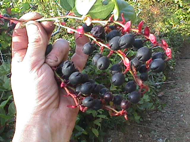
Vinland, the Viking’s plainly tell, contained
giant trees, giant salmon, and vines with fine, fat wine berries. These things don’t grow today in
Newfoundland and we have no evidence that they did when the climate was warmer.  Eastern Canadian
salmon are smaller than Norwegian and even Swedish salmon- they would not have impressed
Vikings as immense. Neither would Eastern
Canadian trees. The salmon and trees of the
B.C. Coast are bigger than any recorded Scandinavian counterparts… they would have
looked awesome.
Eastern Canadian
salmon are smaller than Norwegian and even Swedish salmon- they would not have impressed
Vikings as immense. Neither would Eastern
Canadian trees. The salmon and trees of the
B.C. Coast are bigger than any recorded Scandinavian counterparts… they would have
looked awesome.
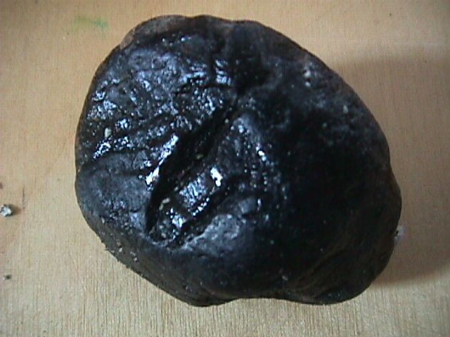
In Vinland they found Quartzite and Anthracite coal, you can’t find these
things on the East Coast.
 This is
anthracite coal and their is a quartzite deposit less then 2 miles up stream.
This is
anthracite coal and their is a quartzite deposit less then 2 miles up stream.
The coal comes from the smelter [winter cave]. on Vancouver island.

Leif Eriksson discovered Vinland in 996. That’s
important! From 800 to sometime between 1200
and 1400 AD. The Arctic Ice pack was far smaller than it has been since then. Viking sailors could roam the Arctic Ocean during
the warmer half of the year.. something nobody can do now.
Being
able to roam the Arctic, the Vikings almost certainly did.. such was their nature and
their navigational skills were already superb. Their
reports of latitude were accurate to less than half a degree, perhaps to a tenth or a
twentieth- a fact we will meet again. Map below…..
Vinland… The sagas tell
us that Eriksson’s first voyage to Vinland was a year long: about ten years after
returning to Greenland he came back with a larger party and stayed three years. Reading the old
accounts, I get a strong intuition that after Eriksson’s larger party abandoned
Vinland, parties from Scandinavia – the territories of what we know today as Iceland,Norway, Denmark,
and Sweden were Differently arranged then—tried to return to Vinland and never made
it back home.
When the arctic ocean froze over-- 1400 AD. or a bit earlier-- Viking travel was
restricted to the Arctic ocean and the Eurasian mainland. Regular sea travel through the
northwest passage never resumed, though special parties led by the heaviest ice breakers
can navigate the area [if the purpose, of the voyage justifies the immense cost.]It has
been centuries since people thought of the Arctic Ocean as open sea
To find Vinland, one must imagine the Vikings perspective, In a time the southern
Arctic Ocean was reliably open during the warm part of the year. Then the accounts in the
sagas make sense.
Leif's account begins in 995, in Greenland. Lief tells his father, Erik the Red, how
he was blown southward of course while in route from Iceland:  He
accidentally found two large Islands [today Newfoundland and Baffin island]and a part of
north American mainland [probably Labrador, Which would have been well wooded in that
warmer time]. He proposes to sail westward and explore what is obviously a large
amount of new land. [Saga quotations are in the translation found in Farley Mowat's
Far West.]
He
accidentally found two large Islands [today Newfoundland and Baffin island]and a part of
north American mainland [probably Labrador, Which would have been well wooded in that
warmer time]. He proposes to sail westward and explore what is obviously a large
amount of new land. [Saga quotations are in the translation found in Farley Mowat's
Far West.]
 The saga
continues..."They made their ship ready for sea ;when all was ready they sailed
...reaching an island which lay to the northward of the country[ the inhabited south of
the west coast of Greenland].[1] see map 1 . They went up and looked about in fine
weather[2].After that they returned to their ship and sailed through the sound which lay
between the island and that cape which projected northward from the land itself".[3]
The saga
continues..."They made their ship ready for sea ;when all was ready they sailed
...reaching an island which lay to the northward of the country[ the inhabited south of
the west coast of Greenland].[1] see map 1 . They went up and looked about in fine
weather[2].After that they returned to their ship and sailed through the sound which lay
between the island and that cape which projected northward from the land itself".[3]
Heading northward [and a bit westward] from south Greenland [which is the only part of
that huge island that was ever inhabited] the large island one reaches is plainly Baffin
island; the translation doesn't tell me clearly if "they looked about them "
refers to exploring one island or several."up there" seems to me to refer to the
northward- projecting cape [ellesmere Island]. in any case, the sound they sailed
through after exploring Baffin island and probably some nearby islands is known as
Lancaster Sound.
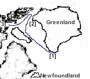
"They sailed westward around the cape"[4]. contains the saga: and from the north
end of Baffin Island it is basically westward all the way to the north cape --
Alaska, at point Barrow.--- See Map#1
 " There they found many hellur. there were many arctic foxes
there. They gave a name to this country and called it helluland[H]. From thence
they sailed for two days and bore away from the south toward the southeast, until they
reached a wooded country containing many animals[I]. An island lay off to the southeast of
this country[J]. Then they sailed southward along this land; after two days
they came to a cape" [K]. At this point they had reached Vinland.
" There they found many hellur. there were many arctic foxes
there. They gave a name to this country and called it helluland[H]. From thence
they sailed for two days and bore away from the south toward the southeast, until they
reached a wooded country containing many animals[I]. An island lay off to the southeast of
this country[J]. Then they sailed southward along this land; after two days
they came to a cape" [K]. At this point they had reached Vinland.
...... see Map # 2 .....
If the directions were to leave Greenland and sail south west for 1 week
till you hit a wooded land, then sail south along the coast till you hit a cape. From the
cape, sail to the viking out post situated on the rock[Newfouldland] Then yes
"Vinland is Newfoundland" 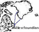 |
Vinland---Mowat's rendering of the
sagas leaves room for two interpretations--either lieafs party rounded the north part of
Baffin island [sailing a very short was westward] and then wound its way back through the
north end of Hudson's Bay, down Davis Strait off the coast of Labrador, to L'anse
aux Meadows; or they sailed a long way west and came down the west coast of north America.
Between these coasts there is no way to reach the 49th Parallel by sea-the southern end of
James bay is at latitude 5? . [in any case, the description of Vinland bears no
resemblance to James bay.] Obviously, there are gaps in the account; and to decide which
coast Lief Erikson reached, one must look at the length of the voyage and his description
of the place.
The saga account doesn't cover 90 days; but it is recorded that it took that long. A
Viking ship could sail, say 100 miles in a day. The journey from southwest Greenland
through the Northwest passage, around Alaska, to the Alexander Archipelago; would total
less then 6000 miles. From there south to the 49th Parallel would be 500-600 miles.
A three month voyage could reach the west Coast with ample time for shore exploration;
while it would be wastefully long to go from Greenland to Newfoundland-- even around
Baffin island, and it is hard to imagine taking such a circuitous rout to a place Lief had
already reached by accident, and could have gone to more directly in a week or two!
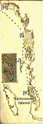
Seen on a globe, the shortest route from Greenland to point Barrow is through the
northwest passage; and the halfway point of the joinery is located somewhere on the north
coast of Baffin Island.
Wherever the gap in the account may have been, sailing southeast from Alaska, via the
Alexander Archipelago and the Queen Charlotte Islands and or- the northern B.C. coast,
Lief's party would indeed have met trees and "many animals".
 By the time they reached the 49th parallel, those trees could have been 15-20
feet thick-- nowhere in Europe or Northeastern North America do we know of any tree more
than 6-8 feet thick; and those biggest trees include oaks and beaches with which the
Vikings would already have been similar. In a warmer climate, Newfoundland could have
contained 6 foot white pines , perhaps; but that's about the upper limit. Such trees
would not have been huge compared with what a similar "climate enhancement"
would have produced in Scandinavia. West Coast species, however, would have impressed even
Vikings. The same is true of the "huge salmon" to which the sagas refer:
Newfoundland salmon are smaller than Scandinavian salmon, which in turn are smaller than
Chinook salmon.
By the time they reached the 49th parallel, those trees could have been 15-20
feet thick-- nowhere in Europe or Northeastern North America do we know of any tree more
than 6-8 feet thick; and those biggest trees include oaks and beaches with which the
Vikings would already have been similar. In a warmer climate, Newfoundland could have
contained 6 foot white pines , perhaps; but that's about the upper limit. Such trees
would not have been huge compared with what a similar "climate enhancement"
would have produced in Scandinavia. West Coast species, however, would have impressed even
Vikings. The same is true of the "huge salmon" to which the sagas refer:
Newfoundland salmon are smaller than Scandinavian salmon, which in turn are smaller than
Chinook salmon.
The Vikings clearly refer
to the "Island of Vinland", and their Vinland map is a rough mirror image of
Vancouver island. The best interpretation I can make of this fact is two fold: They knew the world was round; and the Vinland
Image is reversed to Symbolize that Vinland is on the other side of the world.
Sailing the northernmost waters , the Vikings would have ready evidence that longitudinal
distances were shorter, the farther north one goes. This might have been much less
evident to low-latitude sailors; because the closer one gets to the pole, the greater the
effect of a north south difference. Having traveled to or beyond the equator, they would
also have noticed that day lengths differ both by season and by latitude
"Discoveries can only happen when you go where something is -- you cannot find it
where it is not. We need to remember to listen to the views and stories of others, and be
willing to accept them. "
Native legends, some of them published, tell of stories of Vikings having visited this
coast. If we accept the truthfulness of the Vikings, they tell us how to find Vinland: It
is a three-month voyage from Greenland. Newfoundland is not. Giant trees and salmon are
here, not on the northwest peninsula of Newfoundland. The Vinland map looks more like our
Island then "The Rock".
With In paddling distance of where I sit now sits the Remains of the most famous lost
Viking kingdom ever"Vinland"
the end
Willie's cave "The medisen mens cave"
It's 2004 and I'm not going to argue about weather I am
right or not about the Vikings, its your choice to believe me or not.
 I make these finds the same way a
researcher At the bms makes a find, in barkly sound. I find them because they and I are
here.
I make these finds the same way a
researcher At the bms makes a find, in barkly sound. I find them because they and I are
here.
In march 1 year ago 05 I found a cave the old Indian story teller told me about. I never
looked for it , I just stumbled on it.
I was after the log.
In it, I found something amazing. I noticed the morning solstice sun will illuminate
the whole 240 feet of the 20 feet high cave wall . This had to be Willis
solstice cave . A dry cave filled with beach sand. The sand makes the cave dry
with a flat plateau some 200 feet long and Its made from clean sand. Its
a solstice cave and should have no Indian dead in it, these caves were sacred. yet
it did have bones.


A body guard's the entrance and these old fishing floats are mixed in with the sand
in the back of the cave a young boy A boy in a old shipping crate , with a big hole in his
skull peared back in the cave , His leg bones are crossed becide him.
Between the two is a spot were you can see something was there, now all that's left
in some boards and fishing floats.
The crate is made with square wooden dowels, clearly from a ship.
I believe Years ago the stuff in the cave showed up in bamfield and I think its the
stuff from the old Roch house. The pirate stuff.
A flint lock musket, 2 smoking pipes, a bronze dagger 2 ships cutlasses.
There is also a cave near some old Spanish mine pits on another island.
It had 12 Spanish soldiers lying in it , full body
armor, all gone now.
It did not take long to see willies cave had pirates marking it.
Pirates?
How did I know, simple, they documented there adventure and left clues for there
leader, the queen.
I figured this body was were the two Spanish soldiers found in bamfield years ago
actually came from. The place the 2 swards, flint lock musket , and 2 smoking pipes,
came from.
There is no doubt the constable Roch did have the stuff.
People laugh at "pirates in
bc" Yet Francis drake was the queens pirates , and he and his cousin john hawknis came here.
They were chasing the Spanish that left us with the old Spanish mine legends , found up
and down the coast.
All have the story of the gold mine but no one has the gold.
>>>>>>>
The best legend about the Spanish gold mine can be found in the book
"the daughters of copper women".
The best way to find out if Drake came
here, is to follow Drakes stories and maps. Read the
book " the secret voyage of sir Francis Drake " and See for your self were drake landed.
Just follow the maps.

 The first map shows he sailed up the coast to VI were he turned into a bay
with a row of islands in front of the bay. two on the left, 1 in the bay and 1 on the
right. He passes between the 3 islands and lands on the inside island. He is clearly
looking into barkly sound.
The first map shows he sailed up the coast to VI were he turned into a bay
with a row of islands in front of the bay. two on the left, 1 in the bay and 1 on the
right. He passes between the 3 islands and lands on the inside island. He is clearly
looking into barkly sound.


The picture placed on the map, shows drakes ship off the broken group islands. You see he
takes a Bering from Mt. Ozart, in Ucluelet and draws the saw tooth range, then a bearing
down the island's to the left. Sanford, Fleming and tzartis.


<<This picture Shows drake being towed past foldger, Edward king , hains, Diana and
helby.
It also has the mountains behind bamfield were the mine is.
He is towed into A bay and ancors it were he stays with
the natives.
He is here to plan an attack With the Indians on Nove Albion.
In sarita bay tom Joe found a coin, It was authenticated as being a 500 year old English
coin , from sir Francis drake.
Tom's family still lives on the site of his ancestors and the location of drakes landing.
Un fortunately , the government has assured us , there was no drake landing in Barclay
sound.
I recently found out toms ant has a bag of gold doubloons A ohait used to dive on a ship
for them.
Its like there hiding history.
And I can see why , the mountain the Spanish mined
was sacred to the first nations the problem is proving this would stop the rapid
deforestation of the yellow cedar that ,before 1986 covered it . I believe the forest
could be logged in such a way as to leave the bio diversity intact. Mining that follows
veins can be done under ground as well..
Its very obvious that it is being prepared for open pit mining, regard less of it's
heritage significance. As for the ecology, it's a refugium a place were the glaciers
never hit.
If you want to learn more about the forest, visit my web site at //forest.facts.tripod.com
Sir Francis Drake was not stupid, he had
his artist and map maker draw what he saw, even had him draw
the dome depicted in the caves on one of the maps . The
site of Nova Albion

The silver/gold mines the Spanish were hauling the gold from, Is mentioned in the
legend in the daughters of copper women [lost gold mine]
The harbor in the picture is Nova Albion.
 Follow the legend of the skull and cross bones and see for your self
who the boy in the box is.
Follow the legend of the skull and cross bones and see for your self
who the boy in the box is.
Is this the son of john Hawkins, drakes cabin boy?
My nephew points out the roof of the cave has soda straw's hanging from the ceiling
creating a spring of fresh water in the cave.
This grotto has 12 feet of sand filling it to the roof. With the sand gone the drops of
water would look like diamonds or quartz on the ceiling of the grotto. It would
create a pool of water in THE shamons cave in a refeugium..
This is not a coincidence, I feel it must
be related to the quartz Crystals at the top of the mountain.
Before you read
the next legend, follow this link and enter willies cave.
The legend of the bc
pirates on skull island.

As documented by young Hawkins.
 "And there upon we all entered the cave. It
was a large, airy place, with a little spring and a pool of clear water, overhung with
ferns.
"And there upon we all entered the cave. It
was a large, airy place, with a little spring and a pool of clear water, overhung with
ferns.
The floor was sand.
Before a big fire lay the Captain
 Indeed, as we found
when we also reached the spot, it was something very different.
Indeed, as we found
when we also reached the spot, it was something very different.
a human skeleton lay, with a few shreds of
clothing, on the ground. I believe a chill struck for a moment to every heart.
'He was a seaman,' said George , who,
bolder than the rest, had gone up close, and was examining the rags of clothing. '
Leastwise, this is good sea-cloth.'
'Ay, ay,'
'like enough; you wouldn't look to find a bishop here, I reckon. But what sort of a
way is that for bones to lie? 'Tain't in natur'.' 
Indeed, on a second glance, it seemed
impossible to fancy that the body was in a natural position. But for
some disarray (the work, perhaps, of the birds that had fed upon him, the man lay perfectly straight--his feet pointing in one direction,
his hands, raised above his head like a diver's, pointing directly in the opposite.
'I've taken a notion
into my old numskull,' observed Silve. 'Here's the compass;
there's the tip-top pint o' Skeleton Island, stickin' out like a tooth. Just take a
bearing will you, along the line of them bones.'
It was done. 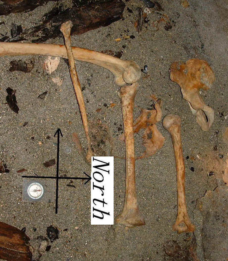 The body pointed
straight in the direction of the island, and the compass read
The body pointed
straight in the direction of the island, and the compass read 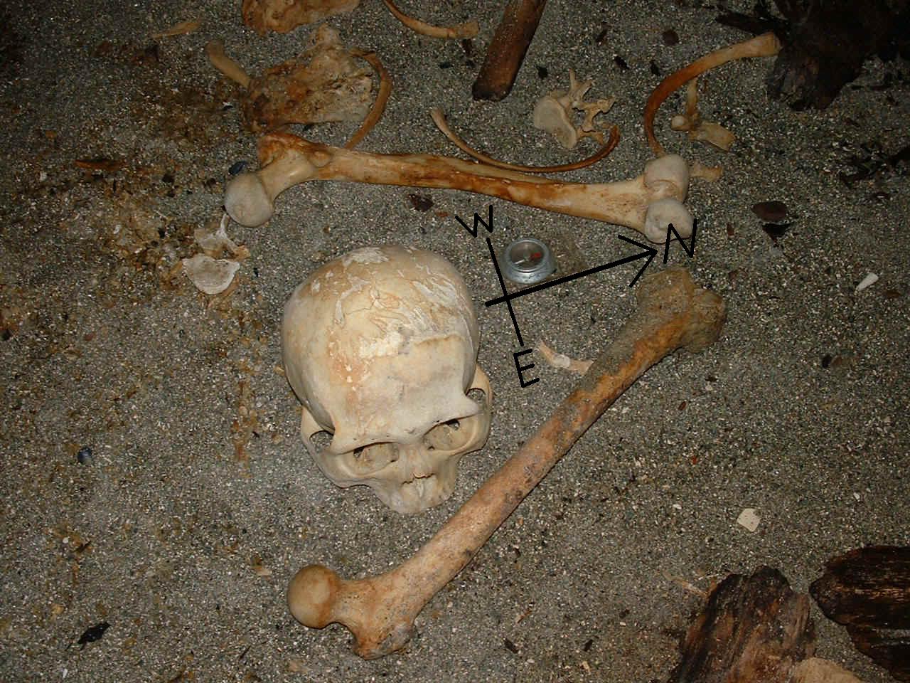 duly E.S.E. and by E.
'I thought so,'
cried the cook; 'this here is a p'inter. Right up there is our line for the Pole
Star and the jolly dollars. But, by thunder! if it don't make me
cold inside to think of
-----. This is one of his
jokes, and no mistake.
Him and these six was alone here; he killed em, every man; and this one he hauled
here and laid down by compass, shiver my timbers! They're long bones,
and the hair's been yellow. Ay, that would be Allardyce. '
'Ay, ay,' returned Morgan, 'I mind him; he
owed me money, he did, and took my knife ashore with him.'
'Speaking of knives,' said another, 'why
don't we find his'n lying round?
He warn't the man to pick a
seaman's pocket; and the birds, I guess, would leave it be.'
'By the powers, and
that's true!'
'There aint a thing left here,' said
Merry, still feeling round among the bones, 'not a copper doit nor a baccy box. It don't
look nat'ral to me.'
'No, by gum, it
don't,' 'not nat'ral, nor not nice, says you. Great guns!
Six they were, and six are we; and bones is what they are now
.
The end
This story was written over 500 years ago
and I did not make it fit the cave , the cave just fits the story,
a story about pirates.
We know what type of boats the Spanish used to get here, but the Vikings and earlier
people used a different type of ship. This link will take you to my theory about how they
made these boats seaworthy.
.
If you have this paragraph
on the page, you are not in the book, this is just
an advertisment for
my book "pass it on".
For more info call or e-mail me at 1 250
728 3631 / pbmont@hotmail.com
To access my book
index follow this link.
 Bamfield is a
very unique town in a very unique place.
Bamfield is a
very unique town in a very unique place.


