 Maps
of Atlantis
Maps
of Atlantis

This old map has Eurasia, 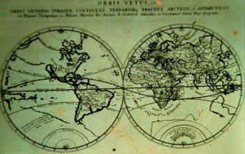 North America and South
America, but what’s interesting is, where the west coast of N.A. is supposed to be,
there is another map imbedded in it, with Atlantis written trough it.
North America and South
America, but what’s interesting is, where the west coast of N.A. is supposed to be,
there is another map imbedded in it, with Atlantis written trough it.
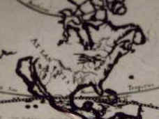
This map shows Atlantis west of America, the common thought is, it’s up side down
with the south on top because Atlantis is supposed to be east of America. 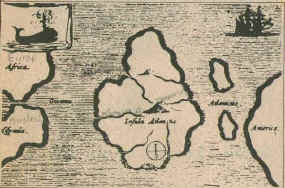
When they spoke of Atlantis before Columbus discovered America, America did not
exist. They would stand on the shores of Europe and point down in the ocean
claming there was a lost continent called Atlantis beneath the waters. Where 10000 years
ago, a mighty continent that was s ruled by a white race of people. What they
did not know was, they were pointing straight at America, a continent with more
pyramids and written history then the rest of the world combined. The spirit cave
man was found in America and is the oldest mummy in the world, nearly 10,000
years old. Evidence is now suggesting that there were white people in America spirit cave
man and Kennewick man are just two of many.
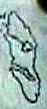
This map is not of Atlantis, but shows an island east of Europe
1000 years ago. 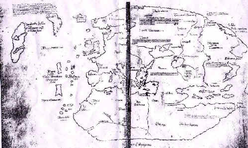
For more on the island of Vinland see my
Viking page. If you click on the inverted island of Vinland below you will see
it resembles Vancouver Island
|
The two maps above seem to indicate that Atlantis lies
west of America and the Vinland map suggests Vinland is Vancouver Island. My thoughts are
Vinland is the island of Atlantis and in fact, both islands are the island of
Atlantis.
To get back to my story, click on this
link.
 Maps
of Atlantis
Maps
of Atlantis